Import georef raster
This tool import common image format associated with a worldfile that georeference it or geotiff file that embed georeferencing informations directly in tiff tags.
Usage : start the operator, select a file and set import options
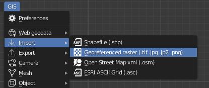
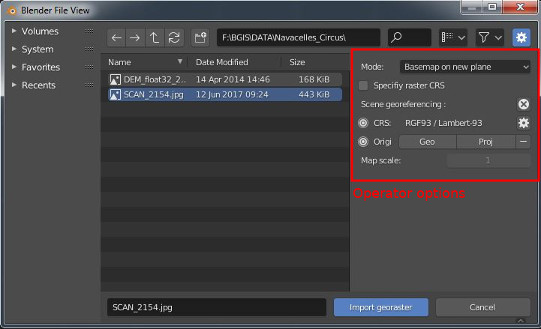
The addon offers differents ways to import a raster image map
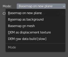
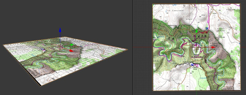
- Basemap on new plane mode creates a new plane mesh that match the geographic position of the raster. This mesh is then textured by UV mapping with the raster image.
-
Basemap as background image adds the raster to the 3D view as empty image. It doesn't create any mesh. Nota : with this mode rotation parameter cannot be taken into account.
-
Basemap on mesh can be used to automatically UV map the raster on an existing mesh.
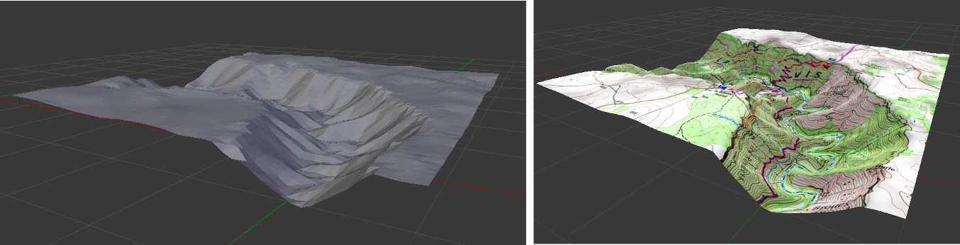
- DEM as displacement texture can be used to warp a mesh with the displace modifier. See the dedicated wiki page.
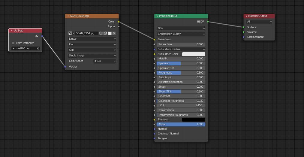
Material node setup
The raster is applied on mesh as a material texture. This material is setting via shader nodes for both Blender Internal and Cycles engine.
Troubles
-
If you don't see any texture on the mesh, try to config 3d view display and shading properties:
- Switch to texture mode
- Tick Textured solid in shading properties panel
-
If the imported image appeared fully black, try to config. the light according to the scene (for example try the sun light type)
-
Because the scene can be very large, don’t forget to configure camera clipping distance according to the scene. If you still see black faces error on render image after setting clip end distance try to set the clip start distance closer to the scene, it will help Blender to improve vertex position according to the Z depth of the camera.