Basemaps
This tool allows displaying a dynamic map directly inside Blender 3dview. The function can feed various kind of OGC web map service : WMS, TMS or WMTS.
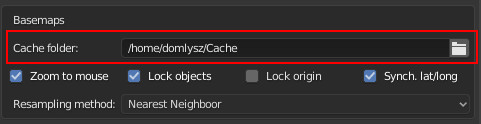
Before using it, a cache folder must be defined in the addon preferences. The downloaded images tiles will be cached in this folder for speed up upcoming request.
Warnings:
- Remember that a map service served in Web Mercator projection does not give reliable distance measurement and so will not be suitable for precision modelling, use a local projection instead.
Usage :
- Toogle map view : start the basemaps operator from GIS menu or with
numpad asterixshortcut - Exit map view :
echap - Switch layer :
spacebar - Search function :
G(go to) - Edit options :
O - Export current map to a new textured plane :
E - Zoom map :
mousewheelornumpad+andnumpad- - Pan map :
left click & dragorwheel click & dragornumpad 2,4,8,6 - Zoom map to drawing box :
B - Lock zoom extent :
L - Zoom 3d view :
ctrl mousewheelorctrl numpad+andctrl numpad- - Pan 3d view :
ctrl left click & dragorctrl wheel click & dragornumpad 2,4,8,6 - Change scale :
alt mousewheeloralt numpad+andalt numpad-
You can navigate the like in any web map, using the mouse whelle to zoom and mouse click to pan. Remember the G shortcut to search for a location. When you're satisfied with the map extent, press E to export it into a new textured plane mesh.
Tips : Sometime the resolution of the image for the desired area is too low, fortunatly it's possible to force basemap to download more detailed zoom level while maintaining the actual extent view. To do this, when basemaps is running and the map view fixed to the desired extent and zoom level, just press L key. A Locked label will appears to the top left of the 3d view. Now, when zooming, the extent area will be maintained as it but the addon will download tiles from highest zoom level increasing the map resolution.
Setup new services : You can add your own service (WMS, WMTS, TMS) by adding its definition in a json like syntax directly in the file servicesDefs.py. You can also define your own custom tile matrix.
Tips : The downloaded tiles are stored in an SQLite cache (Geopackage) that can be openned in any GIS software.
Reprojection support :
- It's possible to seed on the fly a cache in local projection from a source in global projection like Web Mercator.
- It's also possible to keep the cache in Web Mercator and just reproject the final image to match the scene CRS
Reprojection is essential to work with an acceptable precision when consume service in Web Mercator.