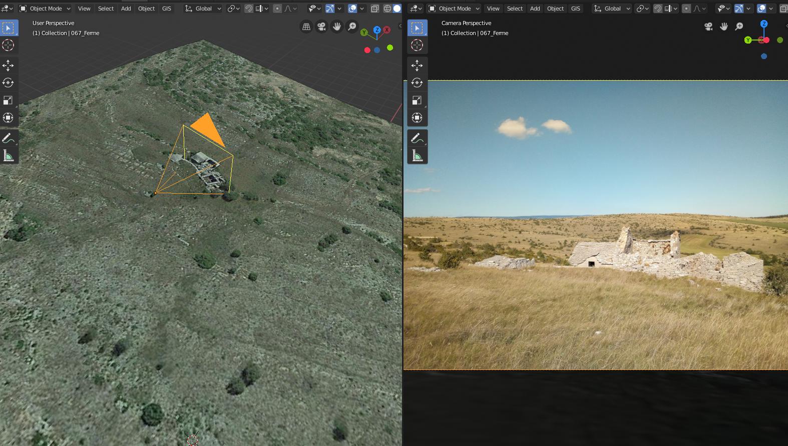
Geophotos import
This operator allows to import geotagged photos (ie any photo with GPS coordinates in it's exif metadata). A new camera will be created and placed to the correct GPS position and will match the photo resolution. The photography is set as camera view backgound image.
This functionnality can help to photomatch a 3d model based on real terrain survey to a given photography.